Since the beginning of September, drone pilots in the Czech Republic have had access to the new digital map DroneMap. It replaces the previous DronView system and clearly shows where special rules, restrictions or prohibitions apply.
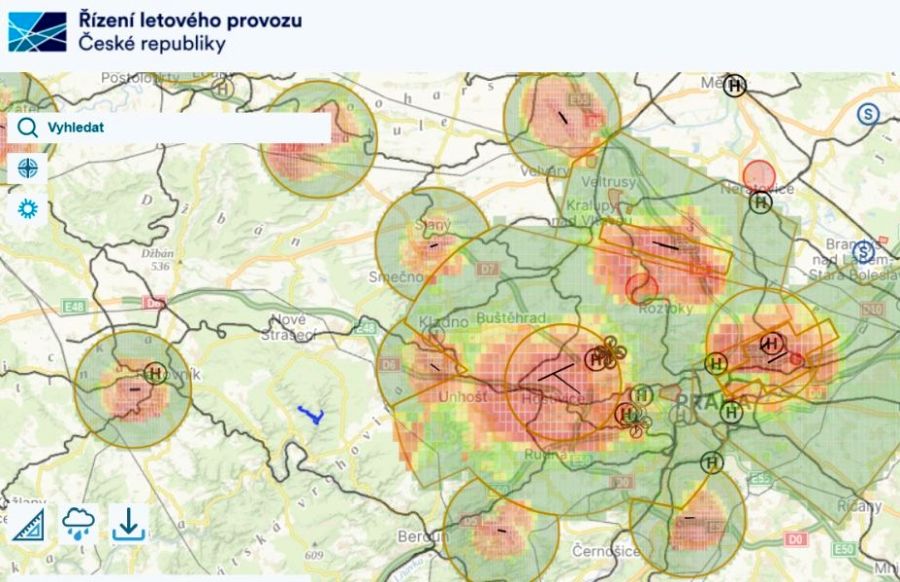
Since 1 September 2025, drone pilots in the Czech Republic have access to a new digital tool: the DroneMap application. It replaces the previously used DronView system and interactively displays the officially defined zones in Czech airspace where special rules, restrictions or prohibitions apply to the operation of drones. The map was developed by the state-owned company Řízení letového provozu ČR (ŘLP ČR), in cooperation with the Civil Aviation Authority (ÚCL) and the Ministry of Transport.
The digital map not only contains information on airspace and no-fly zones around airports, but also references to protected areas, densely populated urban zones, heliports, roads and railway lines, energy facilities, water sources and sites important for national security. In addition, users can manage their own drone operations, plan and archive flights, or make them visible to others if necessary. Practical functions such as distance measurement and current weather data round off the service.
The application reflects the current legal framework in line with the specifications of the Civil Aviation Authority. It also refers to the information campaign Létejte zodpovědně (Fly responsibly), which aims to familiarise drone pilots with the applicable rules. The new digital map DroneMap is available at dronemap.gov.cz.
A mobile version is already in development. The creators are focusing on user-friendliness and are actively incorporating feedback from practical use into further updates.
The number of drone violations in the Czech Republic is steadily increasing, prompting the Civil Aviation Authority to step up inspections and fines. In particular, the airspace above airports and Prague Castle remains a hotspot for illegal drone flights. DroneMap provides now drone pilots with a modern digital tool to find out how and where they can legally fly their drones.